Home → Hunting & Trapping → Hunting → Game Species → Deer → Expanded Archery Season on Deer → Eastport Area
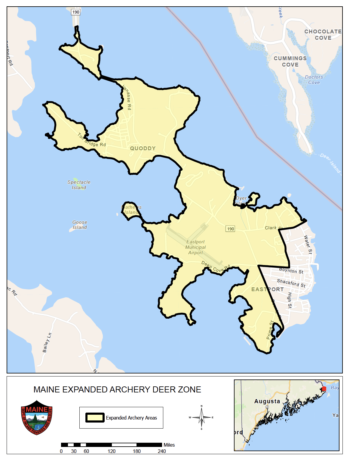
Boundary Description for the Expanded Archery Season on Deer - Eastport Area
To view PDF documents, you will need the free Adobe Reader. If you need assistance, view our PDF Help page, or email us.
Eastport Area:
Those portions of Eastport that are connected to the mainland by low tide or man-made structure except that the following portion of Eastport is not included within the Town of Eastport expanded archery area: beginning at the intersection of County Road and Washington Street (State Route 190) in Eastport; then following Washington Street easterly to High Street; then following High Street northerly to Clark Street; then following Clark Street easterly beyond its eastern terminus to the coast of Maine; then following the coast of Maine southerly to a point directly south of the southern terminus of County Road; then following northerly to the southern terminus of County Road; then following County Road northerly to the point of origin at the intersection of County Road and Washington Street (State Route 190) in Eastport.